
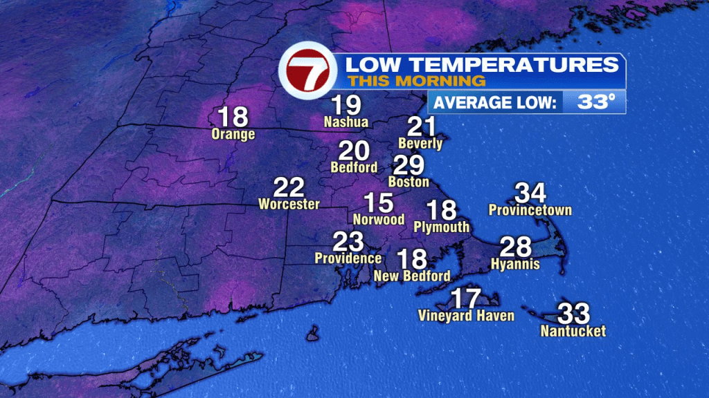
Brrr… back to back chilly starts across the area as morning temps once again start off in the teens and 20s. It’ll be dry from start to finish today and at least the winds are fairly light too. Tonight will be cold again, temps falling back into the teens and 20s.
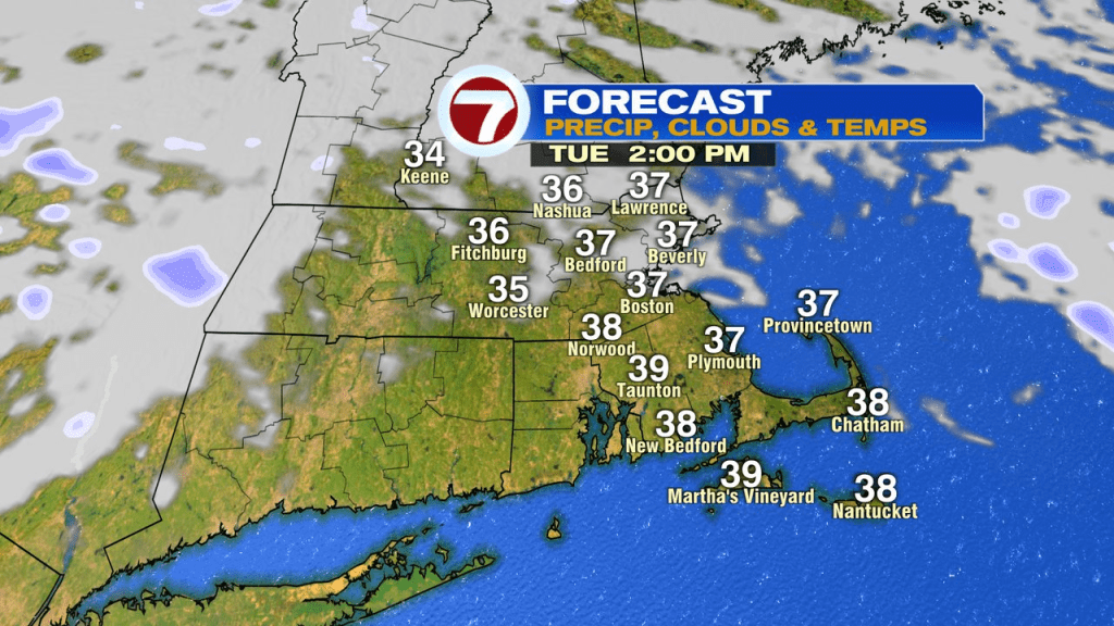
We’ll bounce back to near 40 tomorrow afternoon as clouds advance in.

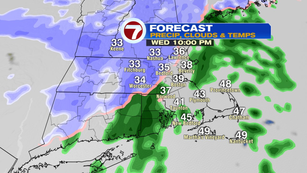
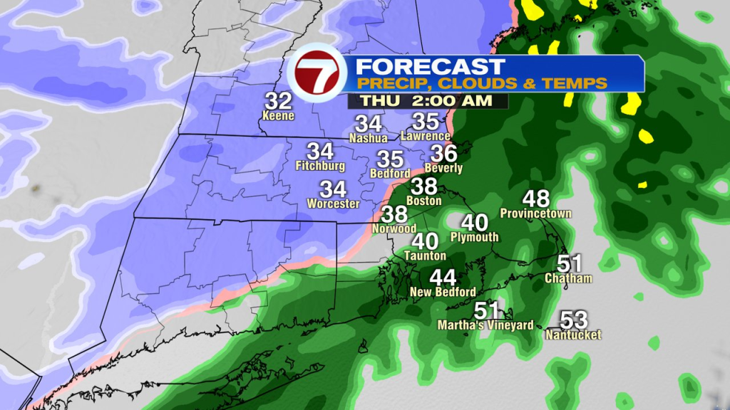
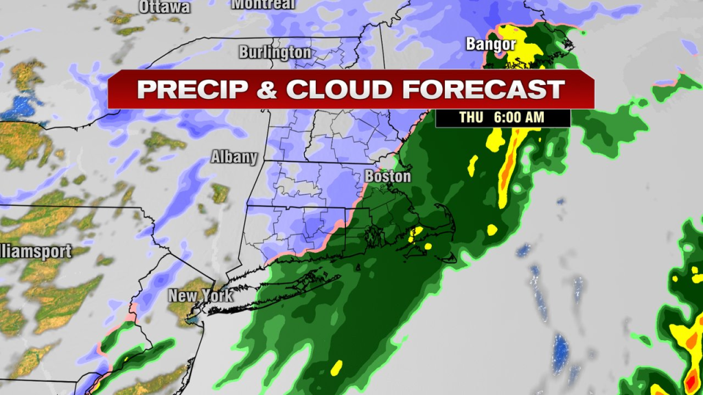
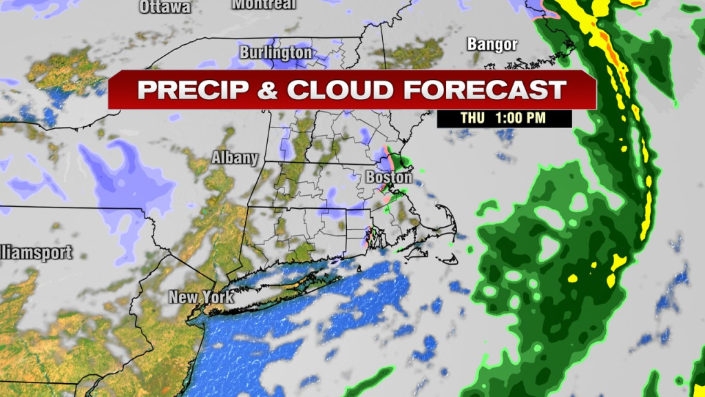
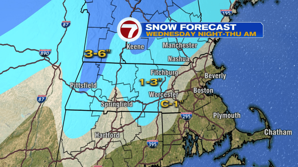
Those clouds do produce rain and snow tomorrow night, into Thursday morning. Any cold air across eastern Mass is limited, so rain will mix in, if not be all rain close to the coast. Inland, especially across the higher terrain, the cold is more sustainable, thus the increased chance of snow. Where it’s mainly snow, 1-3″ falls outside 495, especially across the higher terrain, where a few locally higher totals area possible. Steady rain and snow tapers mid to late morning Thursday and a gusty breeze develops out of the west. There will be the chance of a midday/afternoon snow squall, but a good chunk of that time frame is dry.
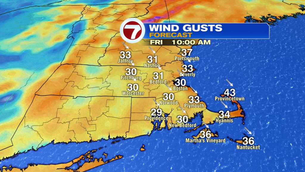
West winds are feisty Friday, gusting over 30mph as cold air comes crashing back in.
The weekend start cold, in the low to mid 30s Saturday with a bit milder air Sunday, near 40. A few spotty snow showers are possible late Saturday or Saturday night, but the bulk of the weekend looks dry.